About GIS
Geographic Information Systems (GIS) is a powerful technology that transforms raw spatial data into insightful, interactive maps and visualizations. GIS integrates data to capture, manage, analyze, and display geographically referenced information. By layering various data types—from demographics and environmental metrics to infrastructure and logistics—GIS creates a dynamic picture of how different elements interact across space.
ioLabs became a certified Esri (Environmental Systems Research Institute) partner. Esri is an American GIS software company best known for its ArcGIS products. Learn more about Esri at esri.com

Esri Member Partner
Tailored GIS Solutions
Our GIS solutions are designed to drive innovation and efficiency. Our solutions are based on our own ioFramework. ioFramework accelerates application development with a comprehensive set of tools and libraries, suitable for projects across various platforms.
Explore more about ioFramework
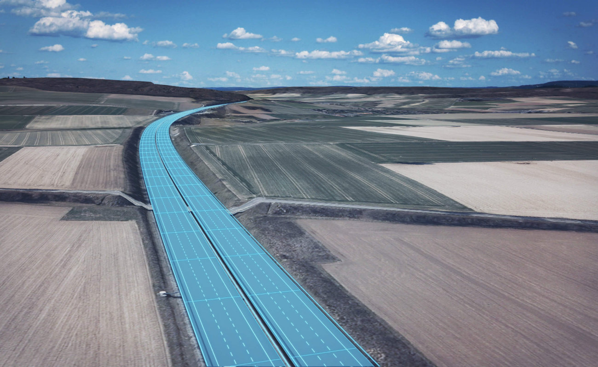
We specialize in developing custom web mapping applications using the ArcGIS API for JavaScript. Our solutions are fast, intuitive, and built on top of the Esri Viewer, customized in both design and functionality. We have extensive experience creating custom widgets, working with complex map layers, performing spatial analyses, and visualizing geographic data in both 2D and 3D.
We tailor our approach to meet the unique needs of each client, ensuring that every project is backed by precise, data-driven insights. Explore how our cutting-edge GIS capabilities can unlock the full potential of your spatial data and provide a strategic edge in today’s competitive landscape.
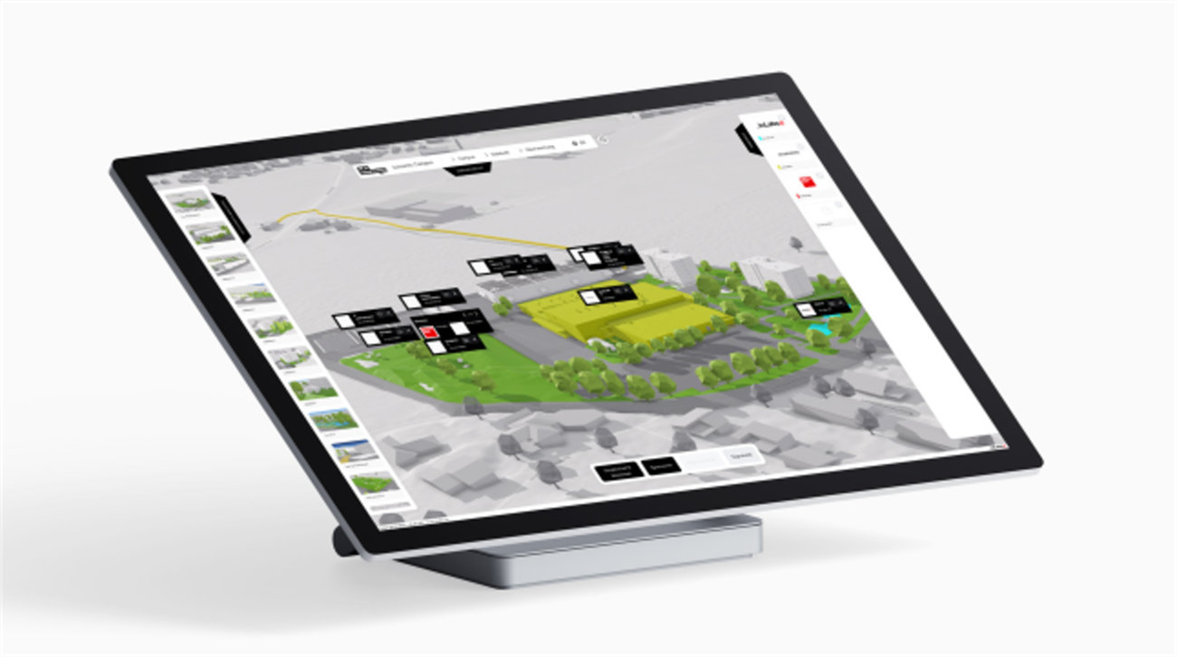
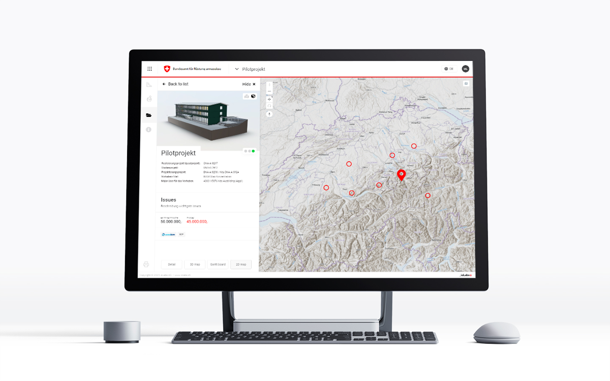
BIM/GIS Integration
The integration of Building Information Modeling (BIM) and Geographic Information Systems (GIS) is revolutionizing the way we plan, design, and manage infrastructure. While BIM focuses on detailed 3D models of buildings and structures, GIS provides geospatial context and analysis for broader urban and environmental planning.
Combining these technologies creates a single source of truth (SSOT) by unifying geospatial and building data in one digital environment. It provides a holistic view of construction projects, urban developments, and infrastructure networks.
Explore more about BIM
Why Choose ioLabs?
-
Expertise and Experience
With a wealth of experience in GIS solutions, our team ensures high-quality outcomes through effective collaboration and support.
-
Proven Track Record
We have successfully integrated GIS solutions and helped projects to bridge the gap between GIS and BIM.
-
Commitment to Excellence
Our focus on innovation and efficiency drives us to deliver exceptional GIS services that meet your specific needs.
Sucess Stories